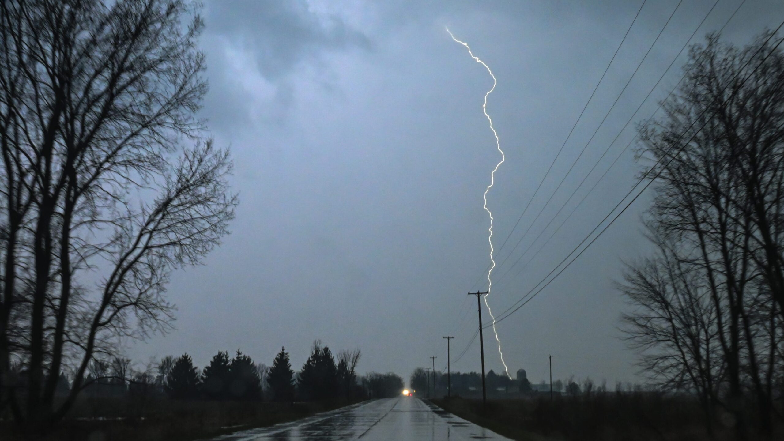
Michigan residents should brace themselves for a mixed bag of weather conditions as severe thunderstorms are predicted to sweep through the Upper Midwest. While the brunt of the storm is expected to hit southern Minnesota, northern Iowa, and western Wisconsin, Michigan is not entirely out of the woods. The state faces a marginal to slight risk of severe weather, with the Upper Peninsula potentially experiencing a higher threat of tornadoes. Stay informed with FYM News as we break down the forecast for different regions and cities across Michigan, ensuring you’re prepared for whatever Mother Nature throws our way. This comprehensive guide will delve into the specifics of the expected weather patterns, offering insights into the timing of thunderstorms, temperature fluctuations, and wind conditions. From the western Upper Peninsula to the southeastern Lower Peninsula, we’ll provide a detailed overview of what each region can anticipate. Prepare for potential disruptions and stay safe by understanding the risks and taking necessary precautions. The National Weather Service has issued warnings about a significant severe weather outbreak across the Upper Midwest. The primary areas of concern include southern Minnesota, northern Iowa, and western Wisconsin, where strong tornadoes, very large hail, and damaging winds are possible. Michigan, while not expected to bear the full force of the storm, still faces a risk of marginal to slight severe weather. The thunderstorms are predicted to commence late on April 28 and continue through April 29. Following this period, clearer skies and milder temperatures are expected to move in statewide on April 30, offering a respite from the tumultuous weather. Residents are advised to monitor weather updates and be prepared for rapid changes in conditions. The Upper Peninsula (U.P.) faces a varied risk landscape, with the western side under an enhanced risk (level 3) for severe weather and the eastern half under a slight risk (level 2). The primary concern in the U.P. is an increased threat of tornadoes, particularly near the Wisconsin-Michigan state line. The National Weather Service anticipates two rounds of thunderstorms affecting the U.P. The first will primarily impact western Upper Michigan in the afternoon, while the second, and more potent, round is expected in the evening and overnight hours. Strong winds and fluctuating temperatures will accompany these storms, urging residents to stay vigilant. In the Lower Peninsula, weather officials are closely monitoring the development of rain and severe weather. The western side of the state has a higher risk of severe conditions, while southern and southeastern cities can anticipate rain and strong winds on April 28. Temperatures across the Lower Peninsula will vary significantly, with northern Michigan experiencing highs in the 40s, while southern cities could see temperatures in the 60s to upper 70s. Detroit residents might even experience a high of 82 degrees. These temperature swings, combined with potential severe weather, necessitate careful planning and preparation. To provide a comprehensive overview, here are detailed weather forecasts for several cities across Michigan: Marquette: Late on April 28, a 60% chance of rain and thunderstorms before 5 a.m., with a low of 39. April 29 brings rain and snow showers, with a high of 36. April 30 will be sunny with a high near 54. Ironwood: Late on April 28, a 100% chance of rain with thunderstorms likely after 1 a.m., with winds gusting up to 30 mph. April 29 has an 80% chance of rain and snow showers, with a high near 44. April 30 will be sunny with a high near 62. Traverse City: Late on April 28, a 100% chance of rain and thunderstorms before 5 a.m., with a low around 44. April 29 brings a 60% chance of rain and thunderstorms, with a high of 38. April 30 will be mostly sunny with a high near 52. Alpena: Late on April 28, a 100% chance of rain and thunderstorms, with new rainfall amounts between a half and three-quarters of an inch. April 29 has a 60% chance of rain and possible thunderstorms, with a high of 40. April 30 will be mostly sunny with a high near 50. Gaylord: Late on April 28, a 70% chance of rain and thunderstorms before 2 a.m., then showers likely. April 29 has a 60% chance of rain, with a high of 41. April 30 will be mostly sunny with a high near 56. Houghton Lake: Late on April 28, an 80% chance of rain and thunderstorms. April 29 has an 80% chance of rain and possibly a thunderstorm, with a high of 43. April 30 will be mostly sunny with a high near 56. Muskegon: Late on April 28, an 80% chance of rain and thunderstorms. April 29 has an 80% chance of rain, with a high of 44. April 30 will be mostly sunny with a high near 52. Saginaw: Late on April 28, a 50% chance of rain with thunderstorms also possible after 2 a.m. April 29 has a 40% chance of showers and thunderstorms, with a high of 68. April 30 will be mostly sunny with a high near 45. Grand Rapids: Late on April 28, a 60% chance of rain and thunderstorms. April 29 has a 60% chance of rain and possibly a thunderstorm, with a high of 60. April 30 has a 20% chance of showers, with a high near 64. Lansing: Late on April 28, a 30% chance of rain and thunderstorms. April 29 has a 40% chance of rain with thunderstorms also possible, with a high near 76. April 30 has a 20% chance of showers, with a high near 64. Detroit: Late on April 28, no rain expected, with a low around 62. April 29 has a 50% chance of rain before 2 p.m., then a chance of showers and thunderstorms, with a high near 82. April 30 will be mostly sunny with a high near 62. Ann Arbor: Late on April 28, a 30% chance of rain, mainly after 3 a.m. April 29 has a 70% chance of rain and thunderstorms, with a high near 79. April 30 has a 20% chance of showers, with a high near 64. Kalamazoo: Late on April 28, a 40% chance of showers and thunderstorms after 2 a.m. April 29 has a 40% chance of showers and thunderstorms, with a high of 75. April 30 has a 30% chance of showers, with a high near 65. The National Weather Service indicates a slight risk of severe thunderstorms for parts of Southeast Michigan between 1 p.m. and 7 p.m. on Tuesday. Detroit residents should stay alert and monitor updates as the situation evolves. Stay indoors during thunderstorms. Avoid using electronic devices connected to power outlets. If a tornado warning is issued, seek shelter in a basement or interior room. Monitor weather updates and heed warnings from local authorities. Secure outdoor objects that could be blown away by strong winds. As Michigan faces the potential for severe weather, it’s crucial to stay informed and prepared. The risks vary across the state, with the Upper Peninsula facing tornado threats and the Lower Peninsula dealing with strong winds and thunderstorms. Keep checking FYM News for the latest updates and detailed forecasts to ensure your safety and well-being. Remember, weather conditions can change rapidly. By staying vigilant and following safety guidelines, you can minimize the impact of severe weather on you and your loved ones. Stay safe, Michigan!
Leave a Reply