The Gulf Coast is bracing for a potential weather crisis as severe storms and heavy rainfall threaten to unleash flash floods across Texas, Louisiana, and neighboring states. As the National Weather Service issues flood watches for over 8 million people, the situation demands immediate attention and preparedness, particularly in areas like New Orleans. This article delves into the unfolding weather scenario, providing insights on the risks, affected areas, and crucial safety measures.
The recent tragic event in Texas, where a 10-year-old girl was swept away by rising floodwaters, underscores the deadly potential of these storms. With forecasters predicting more heavy rainfall, understanding the New Orleans weather forecast and taking proactive steps is more critical than ever. This comprehensive report aims to keep you informed and prepared for the days ahead.
Current Weather Situation
As of May 7, the Gulf Coast is under high alert due to a persistent threat of severe weather. The National Weather Service has issued flood watches spanning across Louisiana, Texas, Arkansas, and Mississippi, affecting millions. In Texas, the aftermath of recent flooding is still being felt, heightening concerns as more storms approach. The situation is further complicated by another round of strong thunderstorms expected to hit South Texas, bringing large hail and additional risks.
The storms are not confined to Texas and Louisiana; the Tennessee and mid-Mississippi valleys, along with the Central Plains, are also bracing for severe weather. This widespread threat highlights the need for residents across these regions to stay informed and prepared for potential flash floods and other weather-related hazards.
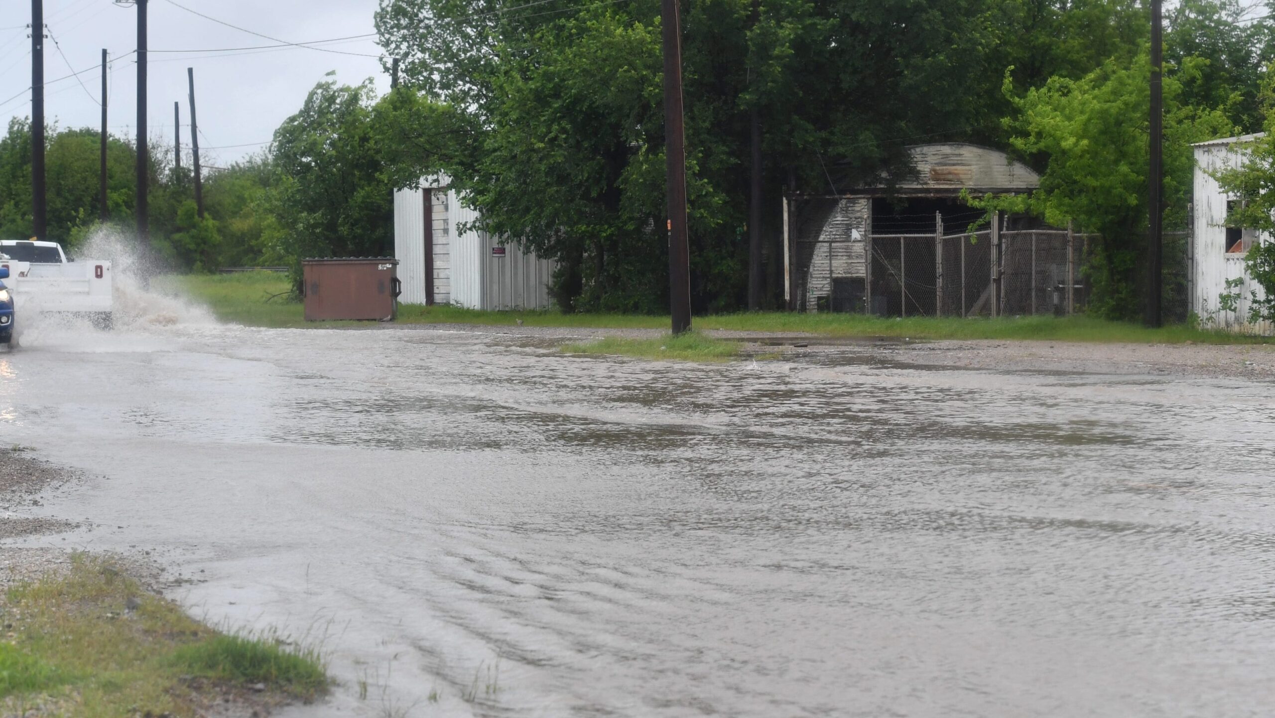
Houston and Galveston Forecast
The Houston and Galveston areas of Texas are bracing for strong to severe storms. Forecasters predict widespread showers and thunderstorms lasting through the early afternoon, with the highest risk of severe weather south of Interstate 10. Residents should prepare for large hail, strong winds, and localized minor flooding.
Looking ahead, more rounds of storms are expected from western and southern Texas along the Gulf Coast, increasing the risk of heavy rainfall and flash flooding. Louisiana is particularly vulnerable, facing the potential for additional flash flooding and excessive rain. These conditions necessitate extra vigilance and preparedness.
Rainfall Expansion into the Southeast
The severe weather pattern is not limited to the Gulf Coast; it is expected to extend into the Southeast, bringing significant rainfall to northern Florida, Alabama, Georgia, and the Carolinas. Predictions indicate that these areas could receive between 4 to 8 inches of rain over the next several days.
AccuWeather has issued an advisory noting that the region could experience “weeks’ worth of rain will fall in a matter of days across parts of the South over the next few days as a storm crawls east.” This forecast underscores the urgency for residents to prepare for potential flooding and related disruptions.
Northeast and Mid-Atlantic Storms
The Northeast and Mid-Atlantic regions are also bracing for more storms. Following recent back-to-back thunderstorms, these areas are expected to receive additional heavy rainfall. The focus will be on higher elevations of northeastern Pennsylvania, northwestern New Jersey, and southern New York.
The continuous rainfall increases the risk of flooding in these regions, particularly in areas with already saturated ground. Residents are advised to monitor weather updates and take necessary precautions to protect themselves and their property.
Flooding Turns Deadly in Texas
Earlier this week, Brenham, Texas, experienced devastating flooding due to heavy rainfall. A tragic incident occurred when 10-year-old Devah Woods was swept away by floodwaters. Despite extensive search efforts, she was found dead, leaving the community in deep sorrow.
The Brenham Fire Department expressed the community’s grief, stating, “This tragedy has deeply affected our community. We ask everyone to continue thinking and praying for Devah’s family during this unimaginable time. In the face of heartache, Brenham has shown what it means to come together – with strength, compassion, and unity.”
The Omega Blocking Pattern
The severe weather patterns affecting much of the country are attributed to an “omega block.” This weather phenomenon is named for its resemblance to the Greek letter omega (Ω). According to Weather.com meteorologist Jonathan Erdman, the jet stream forms an omega shape across the U.S., blocking the typical west-to-east flow of storm systems.
This blocking pattern prevents the usual movement of storms, leading to prolonged periods of unsettled weather in certain regions. The result is the locking in of chilly and unsettled conditions in some areas while milder, dry conditions prevail elsewhere. This pattern is typical of April and May, exacerbating the current weather challenges.
Conclusion
The severe weather conditions sweeping across the Gulf Coast and other parts of the United States pose significant risks, including flash floods, strong storms, and heavy rainfall. As communities brace for more unsettled weather, it is crucial to stay informed, heed warnings from local authorities, and take proactive measures to ensure safety.
For residents in New Orleans and surrounding areas, understanding the local weather forecast and preparing for potential flooding is of utmost importance. By staying vigilant and taking necessary precautions, we can mitigate the impact of these severe weather events and protect our communities. Remember to monitor updates from trusted weather sources and follow safety guidelines to navigate these challenging times effectively.
Leave a Reply