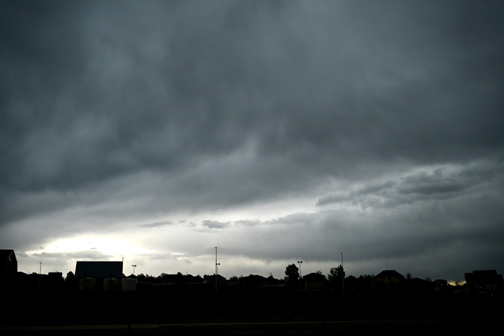
Colorado residents are bracing for a day of severe weather as the National Weather Service has issued a tornado watch for southeastern parts of the state. The alert, in effect until 9 p.m. Wednesday, warns of the potential for multiple tornadoes, scattered wind gusts up to 70 mph, and particularly concerning, the possibility of apple-sized hail. This weather event poses a significant risk to both property and personal safety, making it crucial for residents to stay informed and take necessary precautions.
The severe weather isn’t limited to the southeast, as other regions, including the Denver metro area, are also under threat of strong thunderstorms. These storms could bring heavy rain and hail, with the potential for flash flooding in urban areas. The combination of these factors makes it a high-impact weather day across much of Colorado, demanding attention and preparedness from residents.
This article provides the latest updates and guidance on how to stay safe during this period of severe weather, including tips on seeking shelter, protecting property, and staying informed through official channels.
Tornado Watch Issued for Southeastern Colorado
The National Weather Service has specifically highlighted southeastern Colorado as being at the highest risk for tornado activity. Counties included in the tornado watch area include La Junta, Yuma, and Lamar. Meteorologists are urging residents in these areas to remain vigilant and monitor weather updates closely.
According to the National Weather Service alert, “This area could see multiple tornadoes, apple-sized hail and scattered wind gusts up to 70 mph.” Apple-sized hail can cause significant damage to vehicles, roofs, and other property, and poses a serious risk of injury to anyone caught outdoors.
Residents in the affected areas should ensure they have a safe place to take shelter, such as a basement, storm cellar, or interior room on the lowest level of a sturdy building. It’s also advisable to have a emergency kit prepared with essential supplies like water, non-perishable food, a flashlight, and a battery-powered radio.
Denver Metro Area Braces for High Winds and Hail
While the tornado risk is concentrated in southeastern Colorado, the Denver metro area is also facing its own weather challenges. A severe thunderstorm warning was issued earlier today, cautioning residents about the potential for high winds and hail. Specifically, winds of up to 40 mph and half-inch hail are possible in areas east of Denver.
The National Weather Service issued a statement noting that the areas around Denver International Airport (DIA), Bennett, and Strasburg are particularly vulnerable to these conditions. The warning, which remained in effect until 4:15 p.m., advised people in these areas to seek shelter in a sturdy structure to avoid injury from flying debris and hail.
The Denver International Airport experienced ground stop due to the thunderstorms which resulted in flight delays. Travelers are advised to check their flight status before heading to the airport and to anticipate possible disruptions throughout the day.
Statewide Weather Outlook: More Storms to Come
The threat of severe weather is not limited to today. Scattered afternoon storms are expected to continue throughout the week and into the Memorial Day weekend. The National Weather Service forecasts a continued chance of thunderstorms each day, with varying degrees of severity depending on the location.
While the plains in southeastern Colorado are expected to face the most intense weather, including the possibility of tornadoes and large hail, other parts of the state can still anticipate heavy rain, gusty winds, and smaller hail. Residents are encouraged to stay informed about the local weather forecasts and heed any warnings issued by the National Weather Service.
Despite the stormy conditions, temperatures are expected to rise throughout the weekend, potentially reaching 90 degrees in Denver by Sunday. This combination of severe weather and rising temperatures creates a dynamic and challenging weather scenario for Colorado residents.
Understanding Hail and Staying Safe
Hail is a form of precipitation consisting of solid ice that forms inside thunderstorm updrafts. Hailstones can range in size from small pellets to several inches in diameter, with the largest hailstones capable of causing significant damage and injury. Hail is considered “severe” when it reaches an inch in diameter or larger.
The National Weather Service provides the following safety tips during a hail storm:
- Seek shelter indoors immediately.
- Stay away from windows, skylights, and glass doors.
- If you are in a vehicle, pull over to a safe location and cover your head and neck with your arms and hands.
- Protect pets and livestock by bringing them indoors or providing shelter.
- Report any damage to your insurance company as soon as possible.
Taking these precautions can help minimize the risk of injury and property damage during a hail storm.
Staying Informed and Prepared
Staying informed is crucial during periods of severe weather. The National Weather Service is the primary source for weather forecasts, warnings, and alerts. Residents can access this information through the NWS website, social media channels, and local news outlets.
It’s also advisable to sign up for weather alerts on your smartphone or other devices. These alerts can provide timely notifications of impending severe weather, allowing you to take action to protect yourself and your property. Additionally, having a battery-powered radio can ensure you receive weather updates even if the power goes out.
Being prepared for severe weather events can make a significant difference in your safety and well-being. Take the time to review your emergency plan, assemble an emergency kit, and stay informed about the latest weather forecasts and warnings.
Conclusion: Prepare and Stay Safe
Today’s severe weather forecast in Colorado highlights the importance of preparedness and vigilance. With a tornado watch in effect for southeastern Colorado and the threat of high winds and hail across the Denver metro area, residents must take the necessary precautions to stay safe.
Whether it’s seeking shelter indoors, protecting property, or staying informed through official channels, taking proactive steps can significantly reduce the risk of injury and damage. As the severe weather threat continues throughout the week and into the Memorial Day weekend, remaining informed and prepared is essential for navigating these challenging conditions.
Remember to monitor weather updates, heed warnings from the National Weather Service, and prioritize safety above all else. By working together and staying informed, Colorado residents can weather these storms and ensure the well-being of their communities.
Leave a Reply