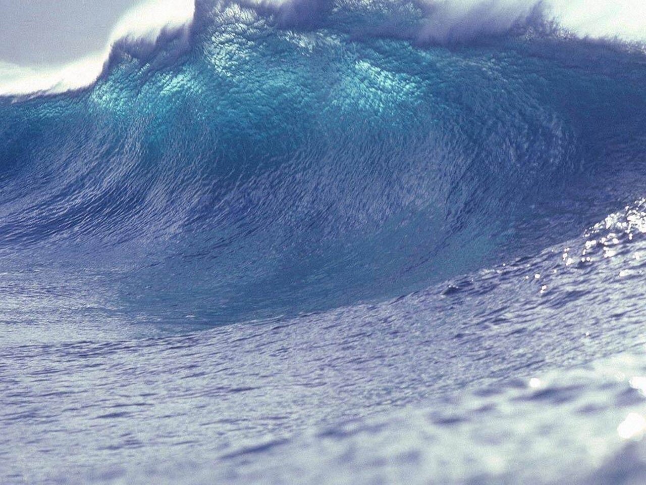
A looming threat hangs over the California coastline: the potential for a devastating tsunami. While tsunamis pose a risk to the entire state, the severity of impact varies significantly by location. This article delves into the regions where damage and casualties could reach catastrophic levels, examining the scenarios that could lead to the worst outcomes. Understanding these risks is paramount for preparedness and mitigation efforts, ensuring communities are ready to face this natural hazard.
California’s diverse coastal geography and seismic activity create a complex landscape of vulnerability. Whether triggered by distant earthquakes or local seismic events, the potential for tsunamis demands a comprehensive understanding of the threats facing specific regions. Coastal communities must recognize potential threats, plan evacuation protocols, and fortify critical infrastructure. This analysis of potential tsunami scenarios will provide information for residents and emergency response teams alike, strengthening overall resilience and safety along the California coast.
Southern California: A Hotspot of Vulnerability
Southern California faces a dual threat from both distant and near-source tsunamis. A distant-source tsunami, originating from an earthquake in Alaska or Chile, could inundate coastal communities with significant wave heights. If evacuation warnings are delayed by just half an hour, the human toll could be staggering. Los Angeles County is projected to experience around 200 casualties, San Diego County approximately 80, Orange County about 60, and Ventura County a dozen.
A hypothetical magnitude 9.3 earthquake in Alaska, similar to the 1964 Good Friday Earthquake, could send waves reaching 15 feet above the mean sea level to Marina del Rey, the Santa Monica Pier, Naples, and Alamitos Bay. Other areas like Long Beach could experience 14-foot waves, while Manhattan Beach, San Pedro, and the ports of Los Angeles and Long Beach might see 10-foot surges. Even Malibu, Redondo Beach, and Palos Verdes Hills are at risk, with estimated wave heights of 9 feet. The potential damage from such an event exceeds $1.4 billion, emphasizing the urgent need for robust mitigation measures.
Near-source tsunamis, triggered by local earthquakes or underwater landslides, pose an even greater challenge due to the limited warning time. Waves could reach coastal areas in as little as 10 to 15 minutes. The most catastrophic scenario involves an underwater landslide, offering virtually no warning before the wave’s arrival. Catalina Island could see waves as high as 30 feet, Palos Verdes Hills 24 feet, and Redondo Beach 11 feet. Given that Los Angeles has an estimated 23,000 residents in the tsunami hazard area and Long Beach 31,000, the importance of rapid evacuation plans is crucial.
Central Coast: The Peril of Underwater Landslides
The Central Coast of California is particularly vulnerable to tsunamis triggered by underwater landslides, making rapid evacuation crucial. A distant-source tsunami could result in more than 230 casualties if evacuations are delayed by half an hour. Santa Cruz County could face over 130 casualties, while San Luis Obispo County might see around 80. Monterey County could experience 16 casualties, and Santa Barbara County seven.
The damage estimate from a distant-source tsunami on the Central Coast exceeds $3.5 billion. Near-source tsunamis, triggered by local seismic events, pose an immediate threat. Both Santa Cruz and Monterey counties could experience tsunamis within minutes following quake-triggered underwater landslides. Public documents highlight the risk, stating that even a moderate earthquake could cause a local-source tsunami from submarine landsliding in Monterey Bay.
A near-source tsunami could bring waves up to 15 feet above the mean sea level in the city of Marina, 9 feet at the Salinas River, 8 feet at the Pajaro River and Sand City, and 6 feet at Moss Landing. Historical events underscore this risk, such as the 1812 earthquake in the Santa Barbara area that resulted in a tsunami wiping out coastal villages and destroying ships. Furthermore, a 1927 tsunami, generated by an earthquake just 5 miles west of Santa Barbara County, produced 7-foot waves. The U.S. Geological Survey (USGS) has found evidence of deposits from underwater landslides offshore of Santa Barbara dating back over 160,000 years, suggesting that future earthquakes could cause large submarine landslides and devastating tsunamis.
Bay Area: High Population Density, High Risk
The San Francisco Bay Area faces significant tsunami risks due to its high population density and unique coastal geography. A distant-source tsunami could result in over 1,300 casualties if people wait half an hour to evacuate after an official warning. San Francisco could experience around 500 casualties, San Mateo and Marin counties about 300 each, Alameda County nearly 200, and Contra Costa County 33. Mendocino County, just north of the region, could see five casualties in such a scenario.
The Bay Area’s complex shoreline can amplify tsunami waves, leading to higher inundation levels. A hypothetical tsunami-generating earthquake in Alaska could provide 5 hours of warning, while one from Chile could provide 13 hours. The maximum projected distant-source tsunami could result in waves reaching 32 feet above mean sea level at San Francisco’s Ocean Beach, 31 feet in Pacifica, 27 feet in Bolinas, 18 feet in Alameda, 14 feet in Sausalito and San Francisco’s Aquatic Park, 13 feet on Alcatraz Island, and 11 feet in Richmond and Treasure Island, as per the California Geological Survey.
The estimated damage from a distant-source tsunami in the Bay Area exceeds $6.5 billion. Near-source tsunamis pose an additional threat. A near-source tsunami in Northern California could generate waves of 9 feet above sea level in Bolinas, 8 feet in Pacifica, 7 feet in Sausalito, 6 feet at Ocean Beach, 5 feet in Alameda, and 4 feet at Alcatraz Island, Treasure Island, Aquatic Park, Redwood City, and Richmond. These factors emphasize the need for comprehensive preparedness plans and rapid evacuation protocols to minimize the potential impact.
North Coast: Proximity to Cascadia Subduction Zone
The North Coast of California, particularly Del Norte County, is exceptionally vulnerable due to its proximity to the Cascadia subduction zone. A major earthquake in this zone could generate massive tsunami waves. If people wait just 10 minutes after an earthquake to evacuate, over 3,150 individuals in Del Norte County and more than 720 in neighboring Humboldt County are at risk of being killed or injured by the tsunami.
Flooding could reach up to 30 feet above the average high tide along the outer coast of Humboldt Bay and the Eureka area, and up to 50 feet toward Crescent City. The historical record shows the potential for immense destruction. Rick Wilson, a former head of the California Geological Survey program, noted that a large quake generated by the Cascadia subduction zone could create waves twice as large as the 1964 event, especially in Crescent City.
Del Norte County, home to Crescent City, could face over $1 billion in damage, while Humboldt County, home to Eureka, could see $22 million in damage. Given the short warning times and potential for immense wave heights, preparedness measures are critical. Coastal communities must focus on early warning systems, evacuation planning, and public education to reduce the risk of casualties and property damage along the North Coast.
Conclusion: Preparedness is Key
The threat of tsunamis looms large over the entire California coast, but specific regions face heightened risks due to unique geographical and seismic factors. Southern California, with its dense population and complex coastal terrain, is vulnerable to both distant and near-source tsunamis. The Central Coast is particularly susceptible to tsunamis triggered by underwater landslides, demanding quick evacuation protocols. The San Francisco Bay Area faces significant risks due to high population density and potential wave amplification from its unique shoreline.
The North Coast, especially Del Norte County, is exceptionally vulnerable to tsunamis generated by the Cascadia subduction zone. Understanding these regional vulnerabilities is paramount for effective preparedness and mitigation efforts. Coastal communities must invest in early warning systems, develop and practice evacuation plans, and educate residents about tsunami risks. Strengthening critical infrastructure and implementing land-use regulations can further reduce potential damage.
The key takeaway is that preparedness is not merely an option but a necessity. By prioritizing tsunami readiness, California can reduce the potential for loss of life and property damage. Coastal communities must remain vigilant, informed, and proactive in their efforts to protect against the inevitable future tsunami events. The collective effort of residents, emergency responders, and policymakers will enhance resilience and safeguard California’s coastal regions for generations to come.
Leave a Reply