The National Hurricane Center (NHC) is closely monitoring a storm system currently brewing in the Gulf Coast. This system, which has caught the attention of forecasters, presents a low chance of developing into a tropical cyclone. Residents and visitors along the Gulf Coast should stay informed and prepared as the week progresses. Understanding the potential risks and heeding the advice of weather experts can help mitigate any adverse effects from this developing weather pattern.
This article will delve into the details of the storm system, examining its potential path, the factors influencing its development, and the possible impacts on coastal communities. We’ll also provide actionable steps you can take to ensure your safety and preparedness. With the hurricane season in full swing, staying vigilant is essential for everyone in the affected region.
National Hurricane Center Flags Gulf Coast Storm
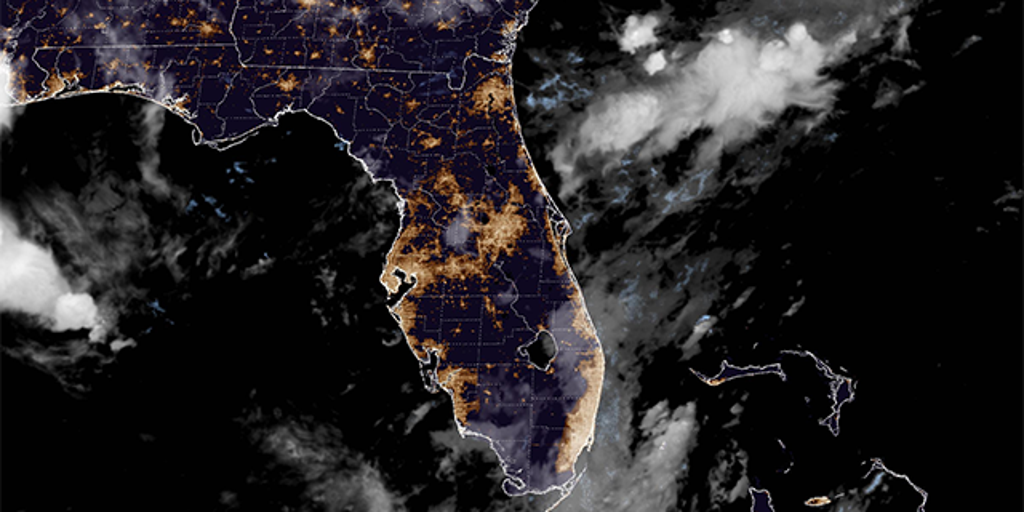
The National Hurricane Center has identified an area of low pressure in the Gulf of Mexico as a system to watch for potential tropical development. This area, situated at the southern end of a frontal boundary, is expected to drift west-southwestward across the north-central Gulf. Much like Invest 93L, which garnered attention earlier in July, this trough presents a degree of uncertainty but warrants close observation.
According to the NHC, environmental conditions could favor some gradual development if the system remains offshore. Water temperatures, upper-level winds, and atmospheric moisture will play critical roles in determining whether this trough evolves into a tropical depression or storm. Residents are encouraged to monitor official forecasts for updates.
Potential Development Timeline
Forecasters predict that the window for this system to develop is relatively short. By the weekend, the storm is expected to move inland, which would effectively curtail its potential for further intensification. The NHC emphasizes that while the probability of development is currently low, conditions can change rapidly, and coastal communities should remain vigilant.
The timeline suggests that the next 48 to 72 hours are critical. If the system remains over water, the warm Gulf waters could provide the necessary energy for it to strengthen. However, any interaction with land would likely disrupt its structure and diminish its chances of becoming a named storm. Keep an eye on the latest advisories for any shifts in the projected path or intensity.
Impacts and Hazards
Even if the storm does not develop into a tropical system, it still poses a threat of heavy rainfall and thunderstorms across the northern Gulf Coast. Models indicate that widespread rainfall totals of 2 to 3 inches are possible, with some localized areas potentially receiving higher amounts. This precipitation could lead to isolated instances of flash flooding, especially in low-lying areas.
Additionally, the persistent southerly flow along the Gulf Coast is expected to increase the risk of rip currents along area beaches. Swimmers should exercise caution and heed any warnings issued by local authorities. The combination of heavy rain, potential flooding, and dangerous surf conditions makes it imperative for residents and visitors to stay informed and take necessary precautions.
Rip Current Risk
A medium risk of rip currents is anticipated along the Florida Panhandle, stretching from Destin to Port St. Joe. Similarly, the Atlantic coast of Florida, from Daytona Beach southward through Melbourne and West Palm Beach, is also expected to face elevated rip current risks through the final weekend of July. These dangerous currents can pull even experienced swimmers away from the shore, making it crucial to swim only in designated areas with lifeguard supervision.
Rip currents are particularly hazardous because they are not always easy to spot. They can appear as dark, calm stretches of water amidst breaking waves. If caught in a rip current, the best course of action is to swim parallel to the shore until you are out of the current’s pull. Once free, swim towards the shore at an angle. Never try to swim directly against the current, as this can quickly lead to exhaustion.
Impacts Already Felt Along Southeast Coast
The effects of the broader weather system are already being felt in parts of the South Carolina Low Country. The combination of higher tides and heavy rainfall has led to street flooding around Charleston. On Monday, downtown Charleston recorded just over an inch of rainfall, which, coupled with limited drainage capacity, resulted in significant flooding on several roadways.
Minor saltwater flooding was also reported around Charleston Harbor on Tuesday, and these impacts are expected to persist until the disturbed weather system moves through the Gulf. This serves as a reminder of the interconnectedness of weather patterns and the importance of preparing for potential flooding even in areas far removed from the immediate storm center.
Conclusion
As the National Hurricane Center keeps a watchful eye on the storm system in the Gulf Coast, it’s crucial for residents and visitors to remain vigilant. While the probability of tropical development is currently low, the potential for heavy rainfall, flooding, and dangerous rip currents remains a significant concern. Staying informed, heeding the advice of weather experts, and taking necessary precautions can help mitigate the risks associated with this developing weather pattern.
The current situation underscores the importance of preparedness during hurricane season. Whether it’s assembling an emergency kit, developing a family communication plan, or simply staying tuned to the latest weather forecasts, proactive measures can make a world of difference. By staying informed and prepared, you can help ensure your safety and the safety of those around you.
Leave a Reply