Dallas-Fort Worth is bracing for a week of typical Texas summer weather: high heat, elevated humidity, and the potential for scattered storms. As we approach the Fourth of July, residents should stay informed and prepared for conditions that could range from sunny and sweltering to stormy and damp. This article provides a detailed outlook on what to expect in the coming days, helping you plan your activities and stay safe.
The forecast includes near-triple-digit temperatures, the possibility of rain early in the week, and insights into when we might see the first 100-degree day of the year. We’ll break down the key points, discuss the summer heat settling in, detail the rain timeline, and provide an extended 14-day outlook. Whether you’re planning a barbecue or just trying to stay cool, FYM News has you covered.
Key Points: DFW Weather This Week
Here’s a quick rundown of what you need to know about the weather in Dallas-Fort Worth this week:
- Afternoon Highs in the 90s: Expect temperatures to consistently reach the 90s, with heat index values potentially hitting triple digits.
- Scattered Storms: Keep an eye out for potential storms, particularly tonight and Tuesday. These could provide temporary relief from the heat.
- First 100-Degree Day Approaching: We’re getting close to the first 100-degree day of 2025. The 14-day outlook suggests it’s on the horizon.
Summer Heat Settles In Over Dallas
High temperatures this week will generally be warmer than usual, from morning lows to afternoon highs. Temperatures will hover in the 90s, exceeding the normal average by one to four degrees. A persistent southerly wind will maintain elevated humidity levels, resulting in heat index values nearing 100 degrees daily. It’s crucial to stay prepared for these conditions.
“The combination of heat and humidity can be dangerous,” warns Dr. Emily Carter, a local health expert. “Make sure to drink plenty of water, wear light-colored clothing, and avoid strenuous activities during the hottest part of the day.”
Rain chances early this week will offer a temporary reduction in daytime highs, particularly on Tuesday, potentially lowering temperatures by a couple of degrees.
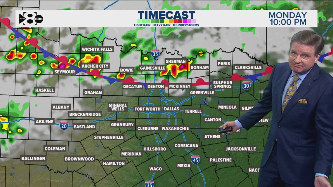
Rain Timeline: When to Expect Storms
The forecast indicates a return of rain chances tonight and into Tuesday. Current data suggests a front will move into North Texas on Tuesday, possibly bringing more widespread showers and storms in the afternoon.
Showers and storms may begin as early as Monday night, primarily along the Red River. Most of these storms are expected to remain near the Red River and into Oklahoma. Although severe storms are not anticipated, isolated storms could produce wind gusts of 50-60 mph and pea-sized hail. Storms should generally clear out by Tuesday morning.
Additional storms are possible Tuesday afternoon as a stationary boundary lingers in the area. The risk of severe weather remains low at this time.
Meteorologist James Wilson notes, “While severe weather is not expected, residents should still monitor local forecasts for any changes. Conditions can change rapidly, especially during the summer months.”
Fourth of July Holiday Weather
The majority of the Fourth of July holiday and the following weekend are expected to be rain-free. Highs will be in the upper 90s, with morning lows in the 70s. There is a slight chance of an afternoon shower or storm west of Dallas-Fort Worth. If you plan to be outdoors, keep this in mind!
“If you’re planning to watch fireworks, make sure to stay hydrated,” advises event organizer Sarah Johnson. “We’ll have water stations available, but it’s always a good idea to bring your own.”
14-Day Weather Outlook for DFW
Temperatures are expected to remain steady in the 90s. A ridge of high pressure will maintain consistent conditions for an extended period. Rain chances remain scarce, but the weather pattern may become slightly more unsettled as we enter July. Monday and Tuesday may bring isolated to scattered showers and storms, though severe weather is not anticipated.
As we approach the peak of summer, anticipate sunnier days and rising temperatures.
Typically, the first 100° day of the year occurs around July 1st. DFW has not yet experienced its first triple-digit day, but it is within the 14-day forecast. Stay tuned for updates as we get closer.
Staying Prepared for DFW Weather
In summary, Dallas-Fort Worth residents should prepare for a week of hot and humid weather, with potential scattered storms early in the week. While severe weather is not expected, it’s essential to stay updated with the latest forecasts and take necessary precautions to protect yourself from the heat.
The key takeaways are to stay hydrated, monitor weather updates, and be ready for both sunny and stormy conditions. As we approach the Fourth of July, remember to plan outdoor activities with the weather in mind and stay safe during the holiday celebrations.
FYM News will continue to provide updates on the weather forecast. Check back regularly for the latest information and stay informed to make the most of your summer week.
Leave a Reply